I'm headed to Vermont as soon as I finish packing. Tomorrow morning I start my Long Trail hike. My cousin Bevan is joining me for the first three days and then I'll be on my own for the rest. (Unless anyone cares to join me. Anyone? The invitation is out there.) I'm leaving the schedule somewhat open although I created a quick map of my projected route with each day's shelter stop marked on the map. The schedule is subject to change, depending on how I feel each day, but the plan is to stay at a shelter each night. (There are shelters approximately every five to 10 miles so I can adjust the schedule as need be.)
View Long Trail 2010 in a larger map
If all goes according to plan I will spend 18 days hiking with rest days after the first and second weeks (in Killington and Stowe, respectively). Jaimee is planning on meeting me for each of these rest days when I will resupply for the upcoming week. Be sure to check my Spot page as I intend to check-in every night, and if I get Internet access during my off-days I'll update the blog with some pictures of the hike. I'm super excited!
Showing posts with label map. Show all posts
Showing posts with label map. Show all posts
Thursday, August 5, 2010


Monday, May 24, 2010
From Rhodes to Crete
Our first stop in Greece was the island of Rhodes, fourth largest of the Greek islands, and only about 11 miles off the coast of Turkey. As we mentioned before we couchsurfed with Savvas in the main town of Rhodes, called imaginatively, Rhodes Town.
Rhodes was quite nice, albeit very touristy. It gets a lot of cruise traffic and the Old Town was swarming with tourists off the cruise ships. It seemed the favorite activity of these cruise ship visitors was to sit in little street cafes drinking gigantic beers. We wondered why, considering isn't drinking what you do all day on a cruise?
Anyway, although we enjoyed walking around Rhodes Town our first full day, we rented a car the next day and did a tour of the island. It took us all day to drive the perimeter of the island, stopping in several towns along the way. Highlights were the town of Lindos, about 25 miles south of Rhodes Town, where a huge Acropolis dominates above a town full of classic white-washed Greek buildings:
We also enjoyed the 15th century Castle of Monolithos on the other side of the island, perched on top of a large rock outcrop. It was incredibly beautiful.
Here's a map of our road trip.
View larger map
From Rhodes we took a 13 hour ferry to Greece's largest island, Crete, where we are now. The ferry stopped at several islands along the way, and we did a Spot check-in at each port. Here's a map of the route:
View larger map
We plan on staying on Crete for about five days or so. We arranged to couchsurf tonight and tomorrow on the eastern side of the island, and we hope to visit the west side before leaving. So far, Crete seems nice and we've seen our first protests; we saw a group of men near the ferry picketing around an open fire. Not sure what their signs said as they were in Greek. We've also heard that there might be a ferry strike coming up. We hope we don't get stuck on the island, but apparently if there is a strike, they'll give two days warning. Here's hoping we don't get stuck in the islands...although I suppose I could think of worse places to be stuck.
Rhodes was quite nice, albeit very touristy. It gets a lot of cruise traffic and the Old Town was swarming with tourists off the cruise ships. It seemed the favorite activity of these cruise ship visitors was to sit in little street cafes drinking gigantic beers. We wondered why, considering isn't drinking what you do all day on a cruise?
Anyway, although we enjoyed walking around Rhodes Town our first full day, we rented a car the next day and did a tour of the island. It took us all day to drive the perimeter of the island, stopping in several towns along the way. Highlights were the town of Lindos, about 25 miles south of Rhodes Town, where a huge Acropolis dominates above a town full of classic white-washed Greek buildings:
 |
| From Rhodes |
Here's a map of our road trip.


View larger map
From Rhodes we took a 13 hour ferry to Greece's largest island, Crete, where we are now. The ferry stopped at several islands along the way, and we did a Spot check-in at each port. Here's a map of the route:
View larger map
We plan on staying on Crete for about five days or so. We arranged to couchsurf tonight and tomorrow on the eastern side of the island, and we hope to visit the west side before leaving. So far, Crete seems nice and we've seen our first protests; we saw a group of men near the ferry picketing around an open fire. Not sure what their signs said as they were in Greek. We've also heard that there might be a ferry strike coming up. We hope we don't get stuck on the island, but apparently if there is a strike, they'll give two days warning. Here's hoping we don't get stuck in the islands...although I suppose I could think of worse places to be stuck.
Thursday, March 25, 2010
Welcome to India
As it turns out, Vietnam was perfect preparation for our visit to India. As readers of our blog know, we didn't find things to be very easy in Vietnam. Buying bus or train tickets was difficult, it was impossible to not get ripped off by taxi drivers, even finding decent, non-touristy food, and getting what we ordered (or wanted) was not always possible. So, the bar of expectations was pretty low when we boarded our flight from Ho Chi Minh City to Chennai, India.
Our flight went through Singapore and we had a wonderful seven hour layover at the Singapore Airport. Wonderful because the airport was clean, we could drink the water from the water fountains, there was cheap food and free wifi. We also visited the post office in the terminal and mailed back 13 pounds of stuff we didn't need to carry around anymore.
We landed in Chennai and passed through customs without a problem (we lucked out being non-Indian as our flight was 90% Indian and "foreigners" had their own customs line at the airport). We had arranged to couchsurf in the southern part of Chennai and after a harrowing ride in an unregistered taxi (at one point I tried rolling the window down and found the door handle instead, but was able to hold on and not fall out) we arrived after midnight.
As usual with couchsurfing, our host is wonderful. She's an American from Connecticut, recently living in Vermont and Colorado before moving to Chennai with her three year old son last year to teach middle school at the American International School. We had fun playing with her son Elijah. Well, at least he had fun. I was mostly a prop (okay, I had fun too):
The reason we started our India tour in Chennai is because when I was working at Keynote Systems in Seattle, I worked closely with a development and support team in Chennai. I'd met two of the people from the Chennai team when they came to Seattle for a visit, but unfortunately one of them was in California for training and the other works in the Bangalore office now. However, I did meet the rest of the team, all of whom I had never met in person.
The office is located in an office park in southern Chennai and illustrates the incredible contrasts that have come to represent modern India. Inside the office park you'd think you were in any other corporate office park in America (complete with security that seems to exist more for show than for real security). Outside, however, is another story. The streets are lined with small shops and run-down buildings and are clogged with rickshaws, motorcycles, cars and buses. Even the train station right next to the office looked abandoned and as if it had been bombed.
About 40% of the people in India live on $1 a day, and wandering around Chennai there is evidence of poverty everywhere. Yesterday we took a walk down to the beach (supposedly the second longest beach in the world) and were amazed at the living conditions of people along the water:
During our three days here (be sure and look at all our pictures to see what we did while here), there have been moments when Chennai seems like a modern, cosmopolitan city, but then we'll pass piles of garbage in the streets or catch the strong whiff of urine to remind us that India is still quite a poor country. It will be interesting to see more of the country and visit some less urbanized areas (although even "small" towns here can have close to one million people). Our planned itinerary is to basically head south along the east coast until we get to the bottom of India, then head north along the west coast through Kerala and Goa until we reach Mumbai. We might also take a detour to Bangalore depending on our time and interest. From Mumbai we'll determine how much further north in India we want to go. Here is a map of southern India which we'll update with the places we stay as we go along:
View World Trip in a larger mapTomorrow, we're catching a bus to the town of Pondicherry (Puducherry), a seaside town with a strong French influence. The bus station we leave from has its own wikipedia page (found while trying to figure out how to take the bus) which says that at 37 acres it's the largest bus terminal in Asia. In many areas it seems, India is all about extremes.
Our flight went through Singapore and we had a wonderful seven hour layover at the Singapore Airport. Wonderful because the airport was clean, we could drink the water from the water fountains, there was cheap food and free wifi. We also visited the post office in the terminal and mailed back 13 pounds of stuff we didn't need to carry around anymore.
We landed in Chennai and passed through customs without a problem (we lucked out being non-Indian as our flight was 90% Indian and "foreigners" had their own customs line at the airport). We had arranged to couchsurf in the southern part of Chennai and after a harrowing ride in an unregistered taxi (at one point I tried rolling the window down and found the door handle instead, but was able to hold on and not fall out) we arrived after midnight.
As usual with couchsurfing, our host is wonderful. She's an American from Connecticut, recently living in Vermont and Colorado before moving to Chennai with her three year old son last year to teach middle school at the American International School. We had fun playing with her son Elijah. Well, at least he had fun. I was mostly a prop (okay, I had fun too):
 |
| From Chennai |
 |
| From Chennai |
About 40% of the people in India live on $1 a day, and wandering around Chennai there is evidence of poverty everywhere. Yesterday we took a walk down to the beach (supposedly the second longest beach in the world) and were amazed at the living conditions of people along the water:
 |
| From Chennai |
View World Trip in a larger map
Saturday, March 6, 2010
Next stop, Vietnam
We are currently hanging out in the central Laos town of Savannakhet. We took a local bus from Vientiane, and it was a fairly uneventful and comfortable ride, although I did rip my shorts on a motorcycle that was in the aisle of the bus. Unfortunately, the shorts are pretty much beyond repair, as they'd already been stitched up twice before by Jaimee, but this time the rips are quite large:

If ripped clothes are the worst of our worries, we're in good shape. After feeling a little under the weather in Vientiane, we both recovered nicely and are having a nice time in Savannakhet. We've used this stop to determine our next few weeks of travel. Back in Luang Prabang, we thought we'd keep heading south in Laos, crossing through Cambodia and then into Vietnam. However, and this will come as no surprise to frequent readers, but we've changed our mind yet again. Being that Savannakhet is on a main highway between Thailand and Vietnam, it has a Vietnamese consulate. We stopped in there yesterday and got 15-day visas for Vietnam. We thought we couldn't get them until Phnom Penh in Cambodia, but they were able to issue them to us on the spot. So, now that we have our visas, and there's a major road from here to Vietnam, we've decided to go to Vietnam sooner.
Our plan now is to head East toward the Vietnam border, stopping for a night or two to see some remnants of Operation Lam Son 719, part of a US ordered, but South Vietnamese Army led attack on the North Vietnamese Army along the Ho Chi Minh Trail. I'm not sure what there is to see exactly, but we plan on staying a night or two in Xepon (also spelled Sepon sometimes) and see if we can find someone who can show us around the old Ho Chi Minh Trail. Here is a map of the area:
The only problem with this plan is we'll enter Vietnam in the middle of the country. We're not sure exactly what our itinerary will be, but we only have 15 days on our visa (getting a longer visa would have taken more time to process) and we would like to visit both the North and South of the country. Also, another big update is that we bought our tickets to India today. We are flying out of Ho Chi Minh City, Vietnam to Chennai, India (via Singapore) on March 23. We found relatively cheap flights on Tiger Airways and decided to go ahead and book the tickets.
Anyway, Savannakhet is a charming, albeit very poor town. There are some remnants of French colonialism here, including a beautiful Catholic Church built in 1930 in the main square.

The town is also along the river dividing Laos from Thailand and one night we had a sunset dinner along the river. We ate at this place where they server you claypot pull of broth and you heat it up over your own coal fire. Then you add whatever vegetables, meat or seafood you want into the broth. It reminded us of our meal in Melaka at Capitol Satay.

We also got a massage, and in all honesty have enjoyed watching movies on HBO at night (yes, our hotel, at only $8 US) includes air-conditioning and HBO. Unfortunately, the only other English channel is CNBC ("First in Business Worldwide!") and despite being an Econ major, I can only take for so long (Jaimee's tolerance is even less). But, HBO has been nice.
Here's the photo album link. We'll add more pictures as we work our way into Vietnam:

If ripped clothes are the worst of our worries, we're in good shape. After feeling a little under the weather in Vientiane, we both recovered nicely and are having a nice time in Savannakhet. We've used this stop to determine our next few weeks of travel. Back in Luang Prabang, we thought we'd keep heading south in Laos, crossing through Cambodia and then into Vietnam. However, and this will come as no surprise to frequent readers, but we've changed our mind yet again. Being that Savannakhet is on a main highway between Thailand and Vietnam, it has a Vietnamese consulate. We stopped in there yesterday and got 15-day visas for Vietnam. We thought we couldn't get them until Phnom Penh in Cambodia, but they were able to issue them to us on the spot. So, now that we have our visas, and there's a major road from here to Vietnam, we've decided to go to Vietnam sooner.
Our plan now is to head East toward the Vietnam border, stopping for a night or two to see some remnants of Operation Lam Son 719, part of a US ordered, but South Vietnamese Army led attack on the North Vietnamese Army along the Ho Chi Minh Trail. I'm not sure what there is to see exactly, but we plan on staying a night or two in Xepon (also spelled Sepon sometimes) and see if we can find someone who can show us around the old Ho Chi Minh Trail. Here is a map of the area:
The only problem with this plan is we'll enter Vietnam in the middle of the country. We're not sure exactly what our itinerary will be, but we only have 15 days on our visa (getting a longer visa would have taken more time to process) and we would like to visit both the North and South of the country. Also, another big update is that we bought our tickets to India today. We are flying out of Ho Chi Minh City, Vietnam to Chennai, India (via Singapore) on March 23. We found relatively cheap flights on Tiger Airways and decided to go ahead and book the tickets.
Anyway, Savannakhet is a charming, albeit very poor town. There are some remnants of French colonialism here, including a beautiful Catholic Church built in 1930 in the main square.

The town is also along the river dividing Laos from Thailand and one night we had a sunset dinner along the river. We ate at this place where they server you claypot pull of broth and you heat it up over your own coal fire. Then you add whatever vegetables, meat or seafood you want into the broth. It reminded us of our meal in Melaka at Capitol Satay.

We also got a massage, and in all honesty have enjoyed watching movies on HBO at night (yes, our hotel, at only $8 US) includes air-conditioning and HBO. Unfortunately, the only other English channel is CNBC ("First in Business Worldwide!") and despite being an Econ major, I can only take for so long (Jaimee's tolerance is even less). But, HBO has been nice.
Here's the photo album link. We'll add more pictures as we work our way into Vietnam:
 |
| Laos to Vietnam |
Thursday, November 19, 2009
Roadtrip Over
After 20 days of traveling up, down and around eastern Australia, we returned the Wicked camper van today. We drove 5,293 km (3,289 miles) and stayed at 16 different places along the way. We checked in with our Spot GPS over 60 times during our trip and we were able to compile them together into the map below.
Map created by SpotAdventures
The last stop was an overnight trip to Phillip Island, about two hours south of Melbourne. We went to the Penguin Parade, where you can view wild penguins returning to their burrows after feeding in the ocean. There were over 1,000 penguins marching across the beach (not all at once - they go in groups and the whole event takes about 45 minutes). Since the penguins breed in stages we got to see penguins of all ages, including super furry baby ones. We were not allowed to take pictures for fear of disturbing them but Jaimee did snap a picture of a chocolate penguin at a chocolate factory:
Phillip Island is kind of weird that way. There are wild penguins on one part of the island and less than five miles away is all sorts of kitchy touristy stuff, including a "grand prix" race track. Also, the Penguin Parade itself was really built up (think Yellowstone or the Grand Canyon but much worse). Hundreds of people view the penguins each night and they sell all sorts of junk in the gift shop, including pop corn, candy and snacks for during the viewing. But apparently the penguins don't mind, just so long as you don't take their picture!
On the way back from Phillip Island we stopped in the Melbourne beach suburb of St. Kilda and met up with our friend Lisa from San Francisco. We hadn't seen her since we stayed with her in California during the second week of our trip. She's here visiting her sister, who like Jaimee's sister Michelle also studied abroad for the semester at the University of Queensland. It was fun seeing Lisa again and sharing travel stories and impressions of Australia (mostly positive).
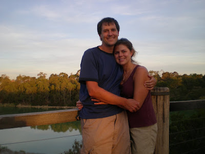
We are back with Nan and Pop for the next couple days with not much planned. We may go into Melbourne tomorrow or Saturday before our flight to New Zealand. We're very much enjoying the suburb of Newport/Williamstown. We went on a walk tonight around a lake near their house and saw a few different kinds of birds, including, apparently not that rare black swans.
Map created by SpotAdventures
The last stop was an overnight trip to Phillip Island, about two hours south of Melbourne. We went to the Penguin Parade, where you can view wild penguins returning to their burrows after feeding in the ocean. There were over 1,000 penguins marching across the beach (not all at once - they go in groups and the whole event takes about 45 minutes). Since the penguins breed in stages we got to see penguins of all ages, including super furry baby ones. We were not allowed to take pictures for fear of disturbing them but Jaimee did snap a picture of a chocolate penguin at a chocolate factory:
 |
| From Around Melbourne |
Phillip Island is kind of weird that way. There are wild penguins on one part of the island and less than five miles away is all sorts of kitchy touristy stuff, including a "grand prix" race track. Also, the Penguin Parade itself was really built up (think Yellowstone or the Grand Canyon but much worse). Hundreds of people view the penguins each night and they sell all sorts of junk in the gift shop, including pop corn, candy and snacks for during the viewing. But apparently the penguins don't mind, just so long as you don't take their picture!
On the way back from Phillip Island we stopped in the Melbourne beach suburb of St. Kilda and met up with our friend Lisa from San Francisco. We hadn't seen her since we stayed with her in California during the second week of our trip. She's here visiting her sister, who like Jaimee's sister Michelle also studied abroad for the semester at the University of Queensland. It was fun seeing Lisa again and sharing travel stories and impressions of Australia (mostly positive).
 |
| From Around Melbourne |
We are back with Nan and Pop for the next couple days with not much planned. We may go into Melbourne tomorrow or Saturday before our flight to New Zealand. We're very much enjoying the suburb of Newport/Williamstown. We went on a walk tonight around a lake near their house and saw a few different kinds of birds, including, apparently not that rare black swans.
 |
| From Around Melbourne |
Tuesday, November 17, 2009
Driving Around Melbourne
We arrived in Melbourne yesterday with Michelle, and as we mentioned we are staying with Yael's grandparents, Nan and Pop. It turns out that Nan and Pop are two of the nicest people we've ever met. They are pure heart and excessively generous with Michelle and by extension us.
Not only did they not bat an eye when we mentioned we might be staying until Saturday when we leave for New Zealand, but they were sad that we weren't staying longer. Today they took us on a drive around the entire Melbourne bay, starting from their house in Williamstown, going out toward Geelong and Queenscliff, taking a ferry across to Sorrento and driving back up to Melbourne to drop Michelle off at the airport by 4PM. We actually didn't stop very often because Pop was concerned about getting Michelle to the airport on time. But we did take this picture on Arthur's Seat State Park near Dromana:
We're having a blast hearing old stories that Nan and Pop tell. They both grew up right after the Great Depression (which even hit Australia pretty hard) and were definitely shaped by World War II. We had no idea how involved Australia was in World War II before speaking with Pop and since Pop was in the Australian Navy (in the Navy band) he has quite a few stories about the war and the years after it. It's also fun to hear the perspectives of someone who has lived in the same house for over 50 years and how things have changed around them.
We've definitely enjoyed meeting locals on our trip and we put Nan and Pop on the top of our list of favorite people we've met so far. Tomorrow we're headed to Phillip Island for the day and night (our last night in the van!) before coming back to Melbourne for a couple days.
Here's a map of Melbourne - Phillip Island is to the bottom right of where this map is centered, below French Island. We hope to see wild penguins and have a look around at the other stuff on the island.
View World Trip in a larger map
Not only did they not bat an eye when we mentioned we might be staying until Saturday when we leave for New Zealand, but they were sad that we weren't staying longer. Today they took us on a drive around the entire Melbourne bay, starting from their house in Williamstown, going out toward Geelong and Queenscliff, taking a ferry across to Sorrento and driving back up to Melbourne to drop Michelle off at the airport by 4PM. We actually didn't stop very often because Pop was concerned about getting Michelle to the airport on time. But we did take this picture on Arthur's Seat State Park near Dromana:
 |
| From Around Melbourne |
We're having a blast hearing old stories that Nan and Pop tell. They both grew up right after the Great Depression (which even hit Australia pretty hard) and were definitely shaped by World War II. We had no idea how involved Australia was in World War II before speaking with Pop and since Pop was in the Australian Navy (in the Navy band) he has quite a few stories about the war and the years after it. It's also fun to hear the perspectives of someone who has lived in the same house for over 50 years and how things have changed around them.
We've definitely enjoyed meeting locals on our trip and we put Nan and Pop on the top of our list of favorite people we've met so far. Tomorrow we're headed to Phillip Island for the day and night (our last night in the van!) before coming back to Melbourne for a couple days.
Here's a map of Melbourne - Phillip Island is to the bottom right of where this map is centered, below French Island. We hope to see wild penguins and have a look around at the other stuff on the island.
View World Trip in a larger map
Sunday, November 1, 2009
Roadtrip Australia
We left Michelle in Brisbane to study for her last finals and rented a camper van to tour the coast of Australia north of Brisbane. We went with Wicked Campers, which as it turns out is not as cheap as we would have hoped (after adding in taxes, insurance, etc.) but since we can sleep in it and it includes a stove to cook on I think it will be fine.
The Wicked Campers are painted all crazy; ours has guns all over it which is kind of annoying, but I think it does make people give us a wide berth, which is useful since I often forget which side of the road I'm supposed to be on.
The Wicked Campers are painted all crazy; ours has guns all over it which is kind of annoying, but I think it does make people give us a wide berth, which is useful since I often forget which side of the road I'm supposed to be on.

We cruised up the coast, stopping at the beautiful beach in Mooloolaba before camping for the night at a road side rest stop. Australia is pretty friendly toward camper vans and at the rest stop we were at there were several other vans staying for the night. It cools off at night and the van was actually pretty comfortable so we slept well.
The next day we continued up along the coast, stopping at a Sunday Market in Peregian Beach, just south of Noosa National Park. We sat on the beach for a while and got back into our van just before the rain came. The weather was not that great but the van was comfortable for sitting and hanging out.
Going north some more we went to our couchsurfing hosts for the night. They live outside of Bundaberg in Coral Cove. What an amazing couple Ely and Val are. They live right on a golf course and we went for a nice walk with them along the water when we arrived.

We had a nice dinner with them and they introduced us to a couple of their favorite Australian TV shows: Border Security and Rove. Both shows were very entertaining. We especially got a kick out of the fact that Val's 75 year old mother (who lives next door with them) got excited for Border Security. The show is a reality-type show about the customs agents in Australia. In the show we saw, an Indian couple got fined $220 each for bringing in contraband food and a man from Taiwan was trying to export live snakes and lizards in his checked luggage. Scary stuff!
Here's a map showing our stops in Australia so far. Australia is a huge country. Our plan is to drive north to Townsville (you'll have to zoom out to see it) before turning around to head back to Brisbane.
View World Trip in a larger map
Wednesday, October 7, 2009
Six peaks, four days
We settled up the bill at our hotel in New Orleans. Somehow the $45 per night hotel ballooned into $76 after adding in all the taxes and fees! Apparently Louisiana state law requires safes in all hotel rooms and hotels charge $4 per night for this? That was just one of the many hidden fees charged. I felt a bit duped with all the extra taxes and fees, but we were glad to see more of New Orleans. It's a great city and one that I hope to visit again in more depth some other time.
From New Orleans we cruised through Mississippi and most of Alabama to camp at Cheaha State Park in northeast Alabama. We got there right as it was getting dark and we found the campground to be a little difficult to figure out. There was an area for RVs but the tent area was labeled "semi-primitive" without designated camping sites. Plus there was a group of American Heritage Girls building fires and roasting marshmellows all over the area. Although the one group leader seemed very nice (they're so polite in the South) we decided to go back to the RV area and pitch our tent in a RV spot.
The next day we got up and climbed the 75 foot tower marking the highpoint of Alabama.
 We also discovered the other tent camping area lining the road leading to the tower. But again, there were no designated sites. People just pulled their cars over and camped on the side of the road. I've seen more orderly homeless people in Seattle.
We left Alabama and crossed over into Georgia, seeking out the highpoint of Georgia. There was a road almost to the top, but it was a 6/10 of a mile walk to the actual highpoint.
 We detoured south into South Carolina for a quick walk up Sassafras Mountain, the South Carolina highpoint before getting on the Blue Ridge Parkway to head toward Asheville. We had a quick beer and dinner in Asheville, but apparently it wasn't quick enough because when we got to the campground at Mt. Mitchell State Park it was padlocked shut! We couldn't get in, and if you were already in I don't see how you could get out either! We also saw a black bear on the road going in to the park.
We continued on the Parkway for a few miles hoping there would be another campground but there was nothing out there. Eventually we gave up and ended up sleeping in the car. It was raining so camping might not have been that fun either. After 50+ days on the road, to have to sleep in the car for the first time wasn't that bad and we slept pretty well actually.
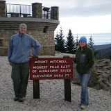
In the morning when the state park opened we drove up to Mt. Mitchell and walked the short walk to the top.


From New Orleans we cruised through Mississippi and most of Alabama to camp at Cheaha State Park in northeast Alabama. We got there right as it was getting dark and we found the campground to be a little difficult to figure out. There was an area for RVs but the tent area was labeled "semi-primitive" without designated camping sites. Plus there was a group of American Heritage Girls building fires and roasting marshmellows all over the area. Although the one group leader seemed very nice (they're so polite in the South) we decided to go back to the RV area and pitch our tent in a RV spot.
The next day we got up and climbed the 75 foot tower marking the highpoint of Alabama.
We also discovered the other tent camping area lining the road leading to the tower. But again, there were no designated sites. People just pulled their cars over and camped on the side of the road. I've seen more orderly homeless people in Seattle.We left Alabama and crossed over into Georgia, seeking out the highpoint of Georgia. There was a road almost to the top, but it was a 6/10 of a mile walk to the actual highpoint.
 From Georgia we headed into the Smokies, camping for a night at Great Smoky Mountain National Park. This is the busiest National Park in the country and October is the second busiest month of the year (after July) although we did find a spot in the campground. In the morning we drove up to Clingmans Dome, the highpoint of Tennessee, and also the highest point on the Appalachian Trail. I thought the structure they built on the top was pretty ugly and wouldn't mind seeing them tear it down to make the highpoint more natural.
We detoured south into South Carolina for a quick walk up Sassafras Mountain, the South Carolina highpoint before getting on the Blue Ridge Parkway to head toward Asheville. We had a quick beer and dinner in Asheville, but apparently it wasn't quick enough because when we got to the campground at Mt. Mitchell State Park it was padlocked shut! We couldn't get in, and if you were already in I don't see how you could get out either! We also saw a black bear on the road going in to the park.We continued on the Parkway for a few miles hoping there would be another campground but there was nothing out there. Eventually we gave up and ended up sleeping in the car. It was raining so camping might not have been that fun either. After 50+ days on the road, to have to sleep in the car for the first time wasn't that bad and we slept pretty well actually.
In the morning when the state park opened we drove up to Mt. Mitchell and walked the short walk to the top.
We then drove further on the Blue Ridge Parkway up into Virginia where we camped at Grayson Highlands State Park, probably the nicest campground we stayed at yet. It was super clean, there were free showers, the host was very hospitable and there were tons of trails. Plus, ponies! (Seriously, there were ponies grazing in the "high country".) We also saw another bear crossing the road.
In the morning, admist lots of rain and fog we braved eight miles (round-trip) of the Appalachian Trail to the top of Mt. Rogers, the Virginia highpoint.
We are now in Durham, North Carolina visiting several of our Seattle friends who have moved here. Durham is an interesting place. It's definitely a place of contrasts. Block to block it changes a lot and while there are some nice areas there are also some very scary areas that I definitely would not venture into at night. But overall, we're having a nice visit here. Tomorrow we head north for our final push to New England. We'll stop one night in Maryland and then it's on to the Catskills of New York for the weekend...
Here's a link to the rest of our pictures from our highpoint frenzy. Also, I have now done 34 peaks of my 35 peak challenge. I'm open to suggestions as to what the 35th peak should be. Let me know in the comments what you think...
 |
| Southern Highpoints |
Tuesday, July 21, 2009
35 Peaks
When I turned 35 last April I decided to set a goal of trying to climb 35 peaks before my 36th birthday. I love to hike, and I knew we'd be taking an extended road trip in the late Summer/Fall so I thought finding peaks to hike would be a great way to add fun excursions to our trip.
Jaimee and I were already planning on climbing Mt. Whitney in California and with a copy of this book (apparently it's out of print, so , I'm glad I have a copy) I thought it would be fun to climb some state highpoints along the way.
State highpoints I have in mind are Mt. Whitney, of course, plus if all goes well, the highpoints of Nevada, Arizona, New Mexico, Texas and possibly Alabama, Florida, Georgia, North Carolina, Tennessee, New Jersey and New York. I won't get ahead of myself with all sorts of planning, and I suppose I should save some for when I turn 50 and I can set that as a goal to hike all 50 state highpoints! (I'm sort of kidding.)
But, as far as the "35 peaks" project goes, any peak or mountain counts toward the goal, as long as it's some sort of highpoint. Here's a map of the peaks so far. I'll keep this map updated so check back. You can also check the picasa photo album (or watch the embedded slideshow below) which I'll add to as I go along. Additionally, I'll post individual entries for each peak with pictures and commentary. Because I know everyone is so interested in this goal of mine...
View 35 Peaks in a larger map
Jaimee and I were already planning on climbing Mt. Whitney in California and with a copy of this book (apparently it's out of print, so , I'm glad I have a copy) I thought it would be fun to climb some state highpoints along the way.
State highpoints I have in mind are Mt. Whitney, of course, plus if all goes well, the highpoints of Nevada, Arizona, New Mexico, Texas and possibly Alabama, Florida, Georgia, North Carolina, Tennessee, New Jersey and New York. I won't get ahead of myself with all sorts of planning, and I suppose I should save some for when I turn 50 and I can set that as a goal to hike all 50 state highpoints! (I'm sort of kidding.)
But, as far as the "35 peaks" project goes, any peak or mountain counts toward the goal, as long as it's some sort of highpoint. Here's a map of the peaks so far. I'll keep this map updated so check back. You can also check the picasa photo album (or watch the embedded slideshow below) which I'll add to as I go along. Additionally, I'll post individual entries for each peak with pictures and commentary. Because I know everyone is so interested in this goal of mine...
View 35 Peaks in a larger map
Tuesday, July 14, 2009
Route Map
Here is a map of our travels.
Pan on map to see all the points, or view Map in a larger page
Pan on map to see all the points, or view Map in a larger page
I will update it as I go along, but the rough plan is to leave Seattle and:
- Backpack in the Enchantments
- Visit Jaimee's Mother and Aunt and Uncle in Idaho
- Visit San Francisco
- Climb Mt. Whitney
- Stop in LA for a Mariner's game against the Angels
- Visit my Aunt in Santa Fe
- Visit friends in Austin, TX and go to Big Bend National Park
- Visit friends in North Carolina
- Stay with family in Vermont and Massachusetts
- Fly to Australia
- Fly to New Zealand
- Fly to Malaysia
- Travel around South East Asia (Thailand, Vietnam, Cambodia, Laos)
- Fly to Nepal
- Fly to India
- Fly to Turkey
- Travel from Turkey to Greece, Italy and other destinations in Europe
- Come home
That's a very rough outline of our trip - we may change the order or add/eliminate stops (I'd love to visit Africa, for example), but I'll keep this map updated with our stops. Since I love maps, I'll be adding other maps along the way showing where we've been or are going.
- Backpack in the Enchantments
- Visit Jaimee's Mother and Aunt and Uncle in Idaho
- Visit San Francisco
- Climb Mt. Whitney
- Stop in LA for a Mariner's game against the Angels
- Visit my Aunt in Santa Fe
- Visit friends in Austin, TX and go to Big Bend National Park
- Visit friends in North Carolina
- Stay with family in Vermont and Massachusetts
- Fly to Australia
- Fly to New Zealand
- Fly to Malaysia
- Travel around South East Asia (Thailand, Vietnam, Cambodia, Laos)
- Fly to Nepal
- Fly to India
- Fly to Turkey
- Travel from Turkey to Greece, Italy and other destinations in Europe
- Come home
That's a very rough outline of our trip - we may change the order or add/eliminate stops (I'd love to visit Africa, for example), but I'll keep this map updated with our stops. Since I love maps, I'll be adding other maps along the way showing where we've been or are going.
Subscribe to:
Posts (Atom)
